Narva-Jõesuu Fishing Harbour
Kalda tn 32a, 29022 Narva-Jõesuu City. Navigation period January 1 – October 30
-
E-mail
sadam@narva-joesuu.ee
-
Phone
+372 53329984
-
Coordinates
59° 27' 33,490" N ; 28° 03' 55,740" E
-
Max depth
0,8 m
-
Max length
15,0 m
-
Max width
3,0 m
Narva-Jõesuu Fishing Harbour
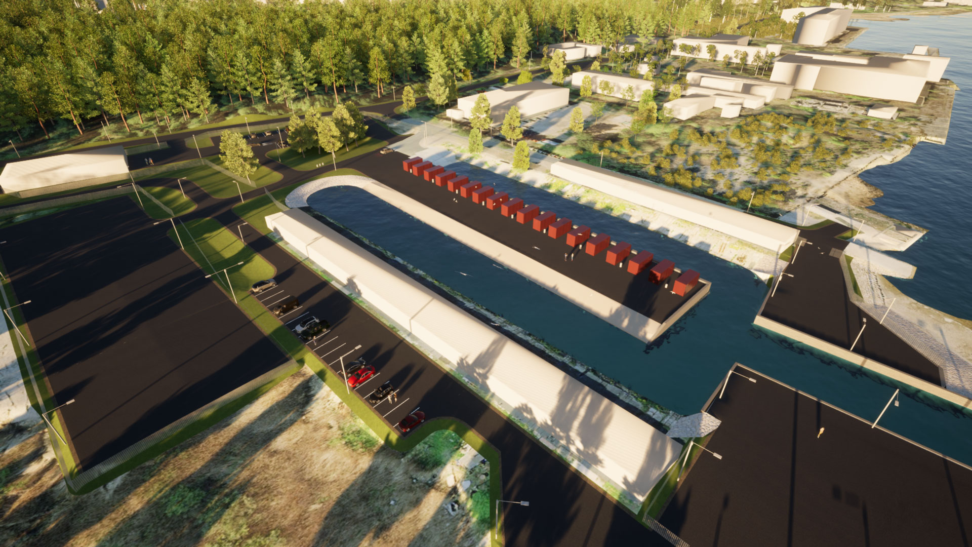
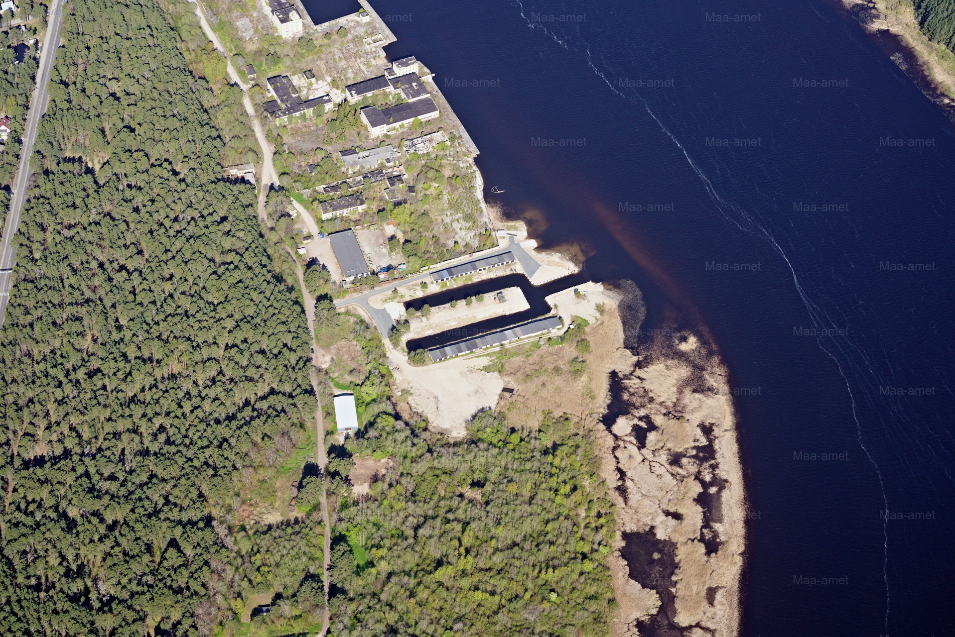
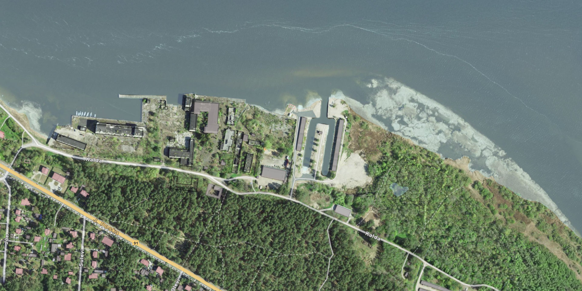
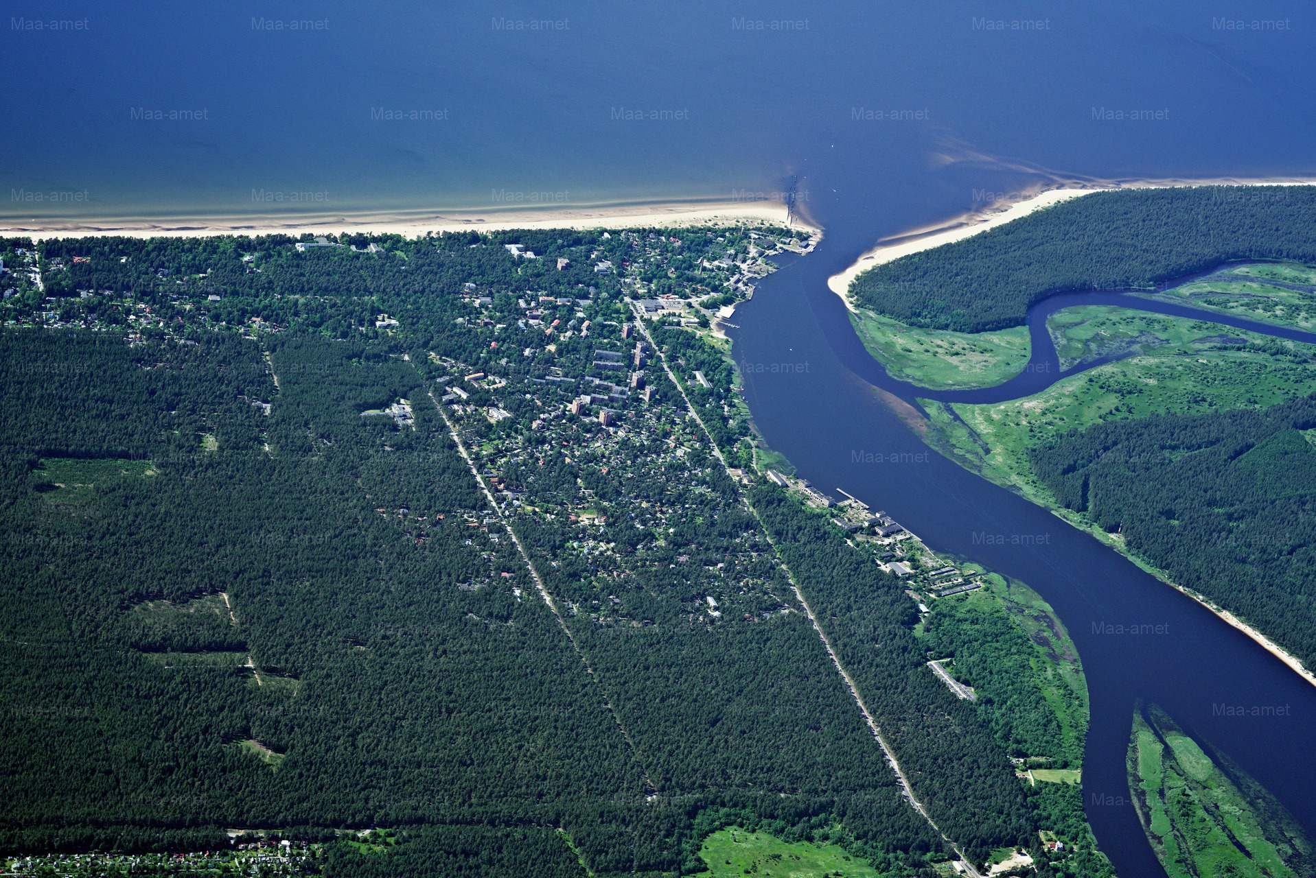
Narva-Jõesuu Fishing Harbour is located on the beautiful Narva River, on Kalda Street, in the historic fishing quarter of the city. It is a small, locally important harbour, the development of which is part of the wider Ida-Viru Waterways and Small Ports Network project. The harbour is registered under the port code EE NJA and is managed by Narva-Jõesuu City Government in cooperation with Narva-Jõesuu Harbour SA.
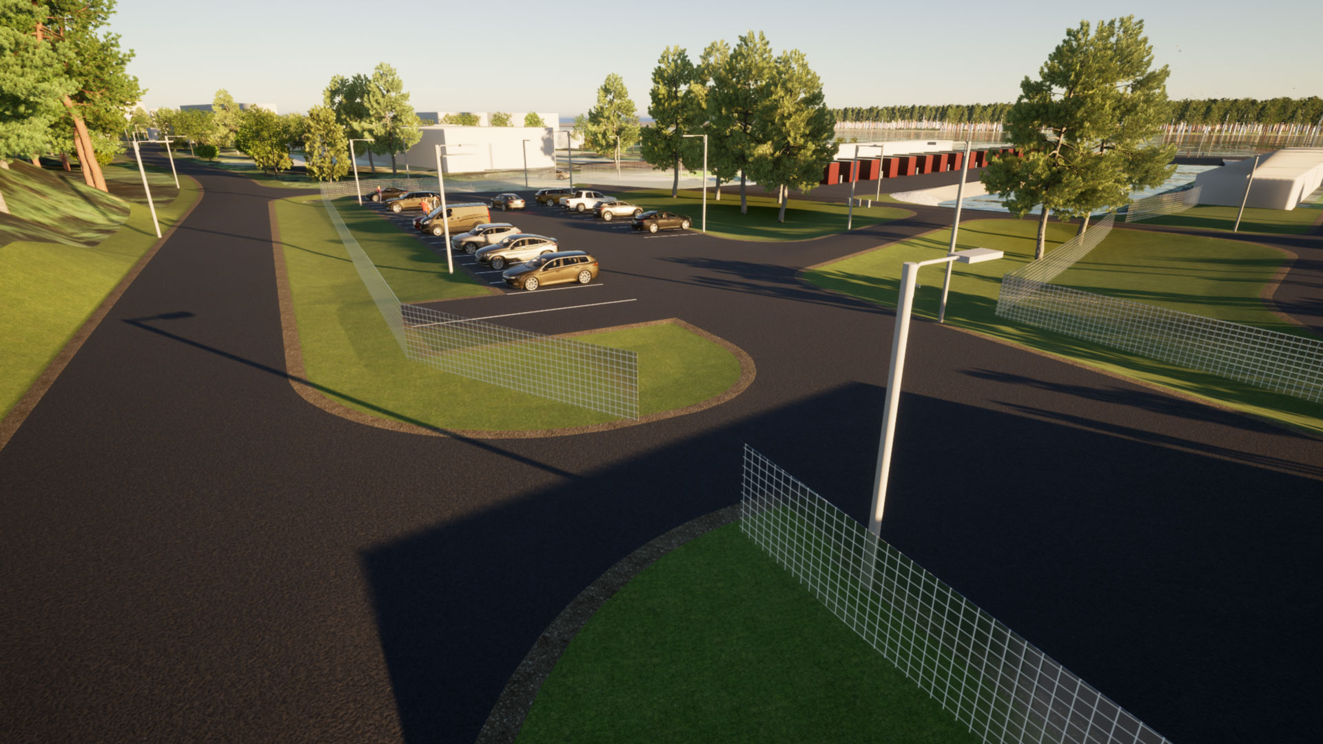
The harbour is currently not providing services – it is undergoing extensive construction and renovation work to transform the area into a modern and safe small port. The works will run until 31 December 2026, after which the port will reopen with upgraded infrastructure and modern services for fishermen, small boaters and water tourism enthusiasts.
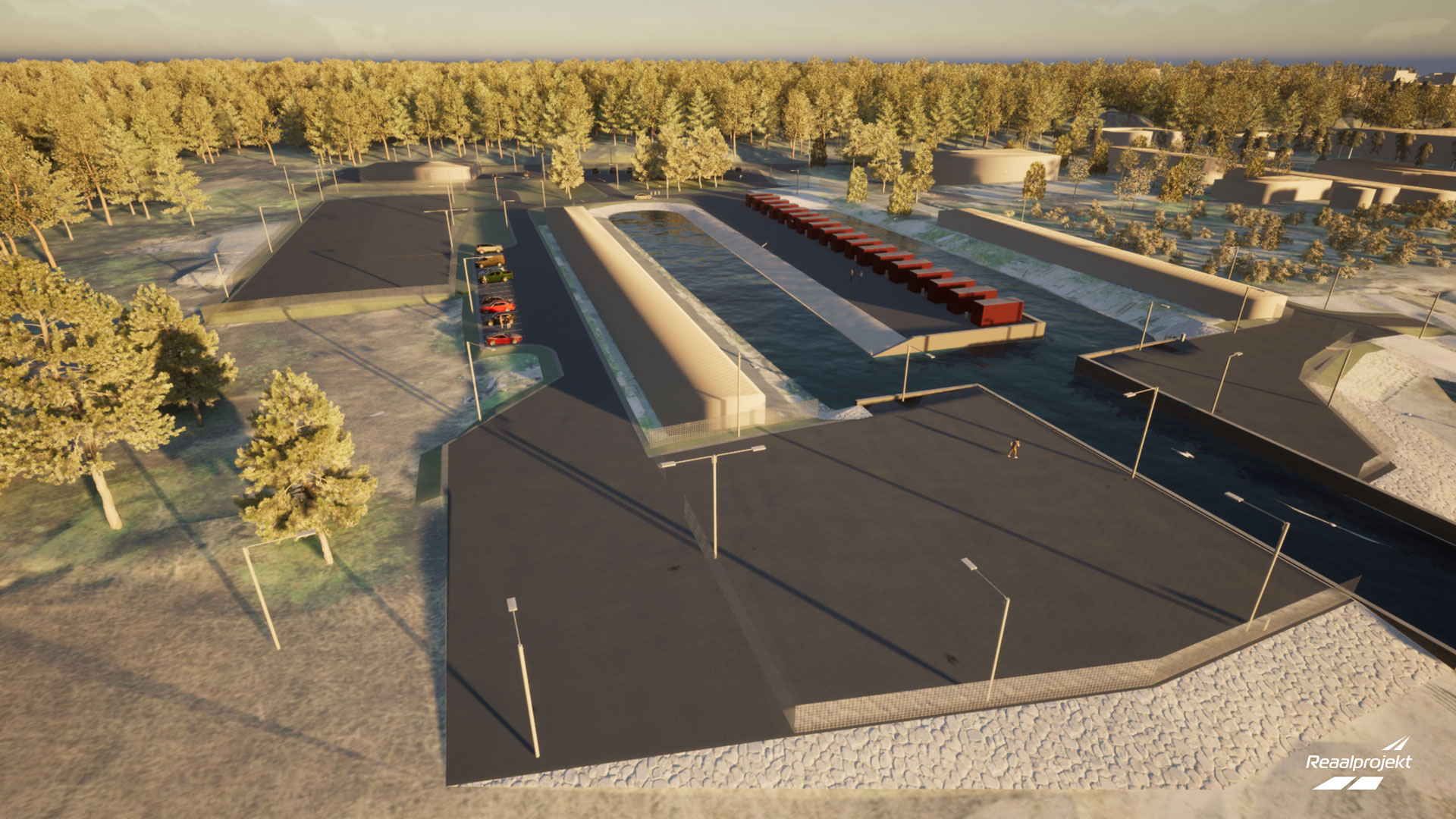
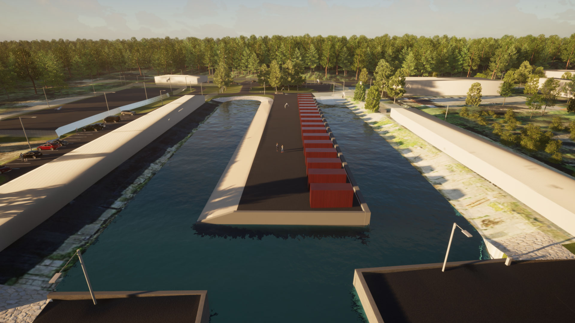
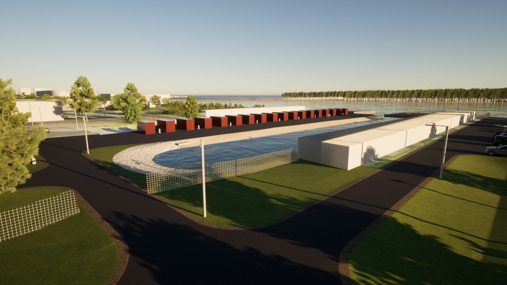
The harbour is located on the banks of the Narva River, a navigable inland waterway with a year-round navigation season. The harbour is located at coordinates 59° 27′ 33.49″ N ; 28° 03′ 55.74″ E. It can accommodate small vessels and fishing boats with a maximum length of up to 8 metres, a maximum width of 3 metres and a draught of about 0.8 metres. The same depth also applies to the harbour access road, ensuring safe access for smaller boats and fishing boats.
The harbour is primarily for the use of the local community and small businesses, creating future opportunities for the development of fisheries, small industries and tourism. The harbour covers an area of approximately 33,600 m², which includes both existing facilities and areas for new development. The future harbour will have a 15-metre long permanent quay, as well as technical facilities such as a fork lift and small maintenance and loading points.
The port is managed by Port Master Deniss Uglanov, who coordinates day-to-day activities and liaises with the city administration and partner institutions. Contacts are:
sadam@narva-joesuu.ee
+372 58503008
The Narva-Jõesuu Fishing Harbour is part of the city’s maritime and water tourism heritage, which has its roots in the centuries-old tradition of fishing villages. When construction is completed, it will once again be a place where work, nature and recreation meet – a small harbour at the mouth of a large river that will give the area a new lease of life.
0,8 m
15 m
3 m
Port services
N.B. The port does not currently offer active services.
Electricity
Parkla
Briefs
Port register
Technical data
TOP DATA
Basic data
| Port code | EE NJA |
|---|---|
| Port address | Ida-Viru County, Narva-Jõesuu City, Narva-Jõesuu City, Kalda 32a, 29022 |
| The port currently provides services | No |
| Reason for not providing services | Construction works in progress at the port. Estimated deadline 31.12.2026 |
| The role of the port | Small port not providing port services for a fee |
| Port services are only provided to vessels with public service tasks. | No |
| Port services are also provided to foreign craft. | No |
| Type of water body | Navigable inland water body |
| Name of the water body | Narva River |
| Navigation period | 1 January – 31 December |
| Registration time | 03.11.2020 |
| sadam@narva-joesuu.ee | |
| Website | https://www.njsadam.ee/ |
| Phone | +372 53329984 |
Contact details of the port operator
| Surname/First name | Narva-Jõesuu City Government |
|---|---|
| Register code | 77000499 |
| Phone | +372 3599580 |
| info@narva-joesuu.ee | |
| Website | https://narva-joesuu.ee/ |
PORT MASTER DETAILS
| Surname/First name | Uglanov |
|---|---|
| First name | Deniss |
| Phone | +372 58503008 |
| sadam@narva-joesuu.ee |
PORT TECHNICAL DATA
Port technical data
| Location of the port | 59° 27′ 33,490″ N ; 28° 03′ 55,740″ E |
|---|---|
| Gross tonnage of the vessel | Less than 500 |
| Maximum length of vessel (m) | 8 |
| Maximum width of vessel (m) | 3 |
| Maximum draught of vessel (m) | 0,8 |
| Minimum width of access road (m) | 7 |
|
Minimum depth of access road (m) EH2000 EH2000 is the height system used in Estonia since 2018, where the depths are based on the so-called ‘Amsterdam 0’.
|
0,8 |
PORT AREA DETAILS
| ID | 51301:005:0001, 51301:005:0015, 51301:001:0094, 51301:005:0009, 51301:001:0291 |
|---|---|
| Area (m²) | 33597,05 |
MAIN PORT SERVICES AND SERVICE PROVIDERS
| Service name | Details of the service provider: name, registration code, telephone, e-mail, website. |
|---|---|
| Allowing mooring of craft |
Narva-Jõesuu City Government, 77000499, +372 5667 2962 sadam@narva-joesuu.ee
|
| Loading and unloading of vessels |
Narva-Jõesuu City Government, 77000499, +372 5667 2962 sadam@narva-joesuu.ee
|
PORT TECHNICAL FACILITIES
| Type of technical instrument | Title | Terms of use |
|---|---|---|
| Other device | Forklift | – |
KAID
| Title | Species | Depth at berth (m) EH2000 EH2000 is the height system used in Estonia since 2018, where depths are reported according to the so-called ‘Amsterdam 0’. | Length(m) |
|---|---|---|---|
| Stationary landing stage | Stationary quay | 0,8 | 15 |
News, announcements
News and offers related to Narva-Jõesuu Fishing Harbour
-
- Posted by Arvo Juhkov
-
- Posted by Arvo Juhkov